


🗺️ Unlock your child’s world of adventure with Collins’ vibrant wall map!
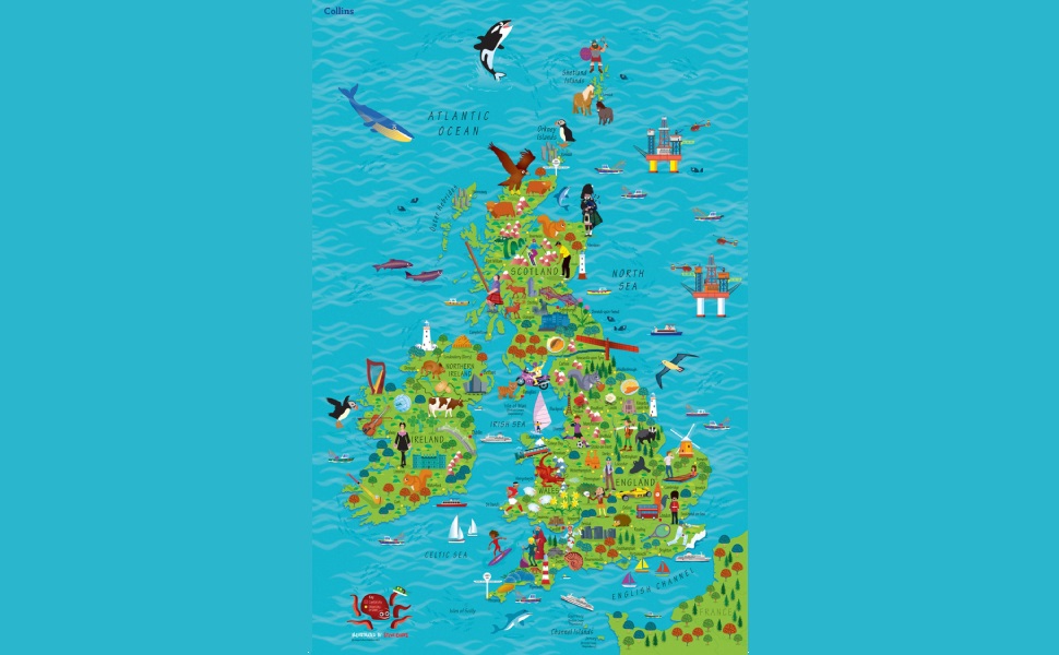
The Collins Children’s Wall Map of the United Kingdom and Ireland is a lightweight, visually engaging educational tool designed to inspire young minds. Weighing just 90 grams, it’s easy to mount in any child’s bedroom. With a strong customer rating of 4.7 stars and a top 100 ranking in children’s atlases, it’s a trusted choice for parents seeking to combine learning with fun.
| Best Sellers Rank | #75,802 in Books ( See Top 100 in Books ) #85 in Atlases for Children #109 in Atlases & Gazetteers #227 in Children's Books on Travel |
| Customer reviews | 4.7 4.7 out of 5 stars (483) |
| Dimensions | 61 x 2.5 x 91.5 cm |
| Edition | First Edition |
| Grade level | Preschool - 3 |
| ISBN-10 | 0008212082 |
| ISBN-13 | 978-0008212087 |
| Item weight | 1.05 Kilograms |
| Language | English |
| Print length | 1 pages |
| Publication date | 4 May 2017 |
| Publisher | Collins |
| Reading age | 4 - 8 years |
L**S
Very nice design
Ideal for kids bedroom
S**I
This is the cutest thing! Very thick paper, vivid and bright colors. Packaging was impressive for a children's map. Big Amazon box and in a map tube.
S**N
Les couleurs sont éclatantes et le papier utilisé est comme plastifié. Me semble de très bonne qualité et solide.
R**A
Ich war von der Size und Qualität echt begeistert. Echt tolle Karte.
C**N
Excellent poster, great for kids and for schools iT's colourful and beautiful. It arrived well. Thank you Amazon
A**R
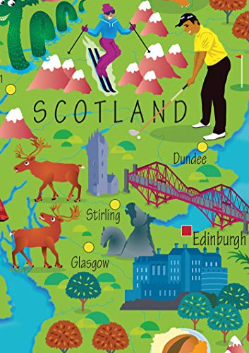
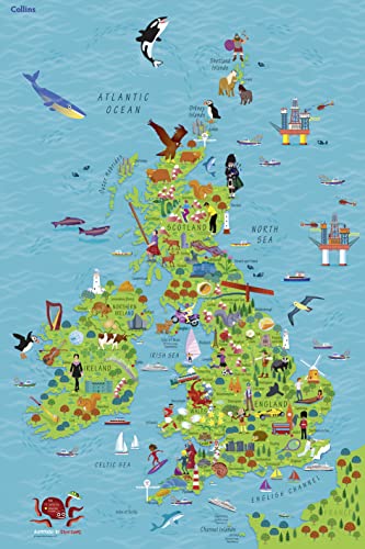
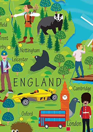
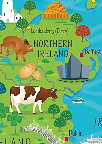
Very good informative map of the British Isles. It shows the types of foods from the different area as well as types of livelihood. You see the marine life found in various areas.
Trustpilot
3 weeks ago
2 months ago