We remain fully operational. Our teams are working around the clock to ensure your deliveries continue safely.

DOWNLOAD THE APP


Copyright © 2025 Desertcart Holdings Limited
DOWNLOAD THE APP


Buy anything from 5,000+ international stores. One checkout price. No surprise fees. Join 2M+ shoppers on Desertcart.
Desertcart purchases this item on your behalf and handles shipping, customs, and support to South Korea.
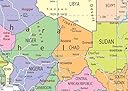
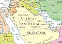
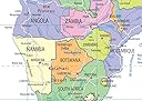
🌍 Discover Africa at a Glance!
This A1-sized political map of Africa is printed on high-quality coated paper and finished with a gloss laminate, making it both vibrant and durable. It features essential geographical details, including capital cities, rivers, and major roadways, perfect for educational or decorative purposes.
| ASIN | B00ET4Z3PK |
| Best Sellers Rank | 694,540 in Books ( See Top 100 in Books ) 1,031 in Educational Charts & Posters |
| Customer reviews | 4.4 4.4 out of 5 stars (27) |
| Dimensions | 59.4 x 84.1 x 0.03 cm |
| Item weight | 100 g |
| Publisher | Tiger Moon |
M**N
Great Map
Ideal product to teach school children about Africa and how it was divided by the early explorers
C**R
Excellent
Presentation
M**Y
African States writ large
This map is large enough for me to clearly see the different countries in Africa and to equate their relevant size in relation to each other - am very pleased with it - it has been a surprise to me in regard to where the different states are situated - well worth the buy
M**E
Belle carte manque de détail !
Trustpilot
2 weeks ago
1 month ago